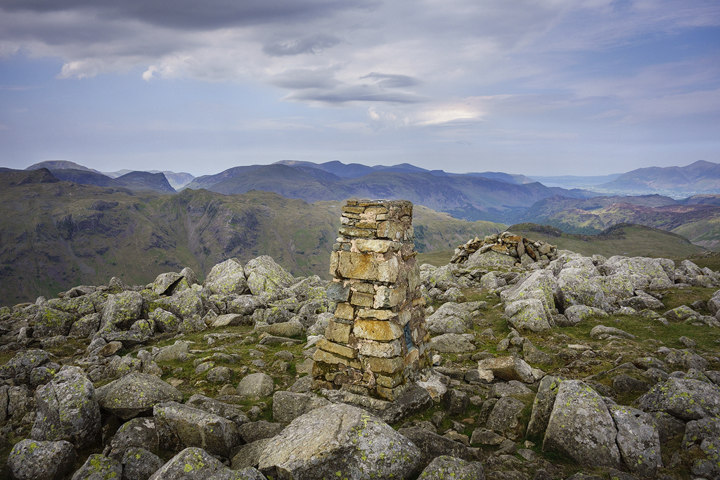
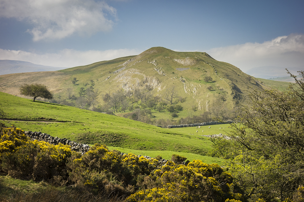
Around a year ago I did a 3 day route from Grasmere around Thirlmere. This is a slightly cut down route as I needed to be home early on the 3rd day. The outward route on this occasion was via Tarn Crag & High Raise before continuing on towards Ullscarth. Last Time I omitted Armboth and from High Seat I continued onto Bleaberry fell where I camped.
Parking in the layby, pack shouldered, I set of through Grasmere taking the woodland path to reach the Easedale road which I followed to Lancrigg where a path takes over to ascend to Tarn Crag.
Path through Easdale
Crossing a foot bridge, I headed south towards Stenners Crag to pick up a faint path ascending NW towards Greathead Crag. Shortly after Tarn Crag comes into view and a stiff pull bought me to the summit.
Bridge over Easdale Gill
Helm Crag, from ascent to Tarn Crag.
Looking back to Grasmere.
Approaching Tarn Crag.
Easedale Tarn.
Tarn Crag.
After stopping for lunch I continued to High Raise, passing Sergeant Man which had quite a few folk on its summit. Arriving at High Raise there was a family having lunch in the stone shelter,so I took a few pics then left them in peace and continued on to Low White Stones.
High Raise
Low white Stones.
From Low White Stones I left the crowds behind as I headed for Ullscarf , from here on I would see no one till the next day.
View from Ullscarth.
Just before High Saddle I branched of NNE following the fence line towards Standing Crag before dropping down to arc round its base whilst trying to avoid dropping too low, I remember some very boggy ground below from my last trip here.
Blea Tarn.
Standing Crag.
Looking back to Standing Crag.
At Middle crag I intended to head to Armboth Fell, but decided to head onto High Tove - High Seat then possibly Bleaberry Fell to camp. Once on High Seat I reluctantly decided it would be too windy for a camp at height. Those who know me, know I always try to camp as high as possible - for the best views but on this occasion a sheltered camp would be more comfortable. Retracing my route back to Middle Crag I headed west towards Armboth Fell.
Armboth Fell, with Browncove crags beyond.
Looking back to High Tove from Armboth Fell.
View towards Thirlmere from Armboth Fell.
After Armboth Fell, my thoughts turned to finding a comfortable camp site for the night , and locating water. Scanning the hillside I noticed a deep ravine which looked like a good prospect for finding water. The recent dry spell meant the tops were very dry , good for walking boggy areas, but at the same time making water harder to source at height. As I neared I heard the heart warming sound of running water and with 4 litres of lakelands finest added to my pack I set about finding a pitch for the night.
I decided to head towards Raven Crag and check out potential spots, the tree line would provide shelter from the strong winds. After around 1/2 hr I decided there wasn't anywhere flat enough that was dry, so I ascended back towards High Seat in the hope of finding Flatter/ dryer ground. Shortly after I found a lovely flat grassy site that wasn't too windy , with a fantastic view towards Thirlmere.
Evening light on Thirlmere from camp.
Camp near Armboth Fell.
With the Trailstar pitched I sat outside and made a brew. Whilst waiting for the water to boil I had my customary whisky to toast the mountains and my day walking amongst them, It was too warm to sit inside the shelter so I sat and watched the lengthening shadows as the sun sank lower in the sky. Eventually it was cool enough to get in my shelter and prepare my evening meal whilst I waited for sunset, But on entering my trailstar I noticed a red ant nest smack bang in the middle of my camp !what to do - move ? I didn't fancy moving camp, and there was no guarantee that another pitch wouldn't have the same problem. In the end I decided to stay put, and covered them with a polycro groundsheet I had - It worked, and they stayed under it - I only received 1 bite, and that was the next morning whilst I was packing, a painful experience that I don't want to repeat any time soon !
Max slept very soundly so they didn't bother him. The sunset was a good one , and after taking some pics and footage I settled down for the night.
Sunrise was a good colourful one and after the usual pics/ footage I made another brew and ate breakfast before packing away- made easier since discovering cuben packing cells from Paul at Treadlite gear, these are excellent for efficient packing and camp organisation.
Pre dawn glow from camp.
Before setting of I checked to see if I'd left anything behind before setting of on day 2.
Sunrise from camp.
Leave no trace... Max didn't want to leave.
Heading back to the fence line I followed the path that skirts the trees Northwards towards Iron Crag. On my last trip I descended past the crags- a lovely quiet wild area. I left the path to take the track that heads towards Castle Crag. Arriving at a gate I found a notice sating my descent path was closed ! I looked at the map but couldn't see another viable option without a lengthy detour, then I noticed the date on the sign which was put there after the strorm back in march , and a statement that it would be closed for no longer than 31 days. As we were now in June I chose to ignore it - presuming that it was now out of date. Firstly though I took the wooden steps to visit Raven Crag - a spot that I was last at with my wife some 7 yrs ago , on that occasion the path was closed and was unpassable so we found another route over rough ground to the summit.
I didn't expect to see anyone one here , but on the summit there was a guy having his morning coffee having spent the night on the exposed summit, in gale force wind in a hammock! he said it wasn't too bad , but rather him than me. After a chat I left him to descend to Thirlmere.
Looking towards Iron Crag.
View towards Iron Crag on ascent to Raven Crag.
Once down in the valley it was clear that today was going to be a warm one, walking along the lane at the damn wall there was a little breeze which disappeared when I joined the path through an attractive wood on the eastern side of Thirlmere. There was still the steep climb to Helvellyn via Browncove Crags ahead, but for now I concentrated on enjoying the walk along the shoreline.
Shortly before the path ascends back towards the road, I took a lunch break at a spot that has become a favourite stop off for my family and me on our way to Keswick for family holiday over the years.
Looking Back to Raven Crag.
Northern end of Thirlmere.
Damn Wall on Thirlmere.
Woodland Path & Bluebells.
Thirlmere from Great How path.
Rested and fed we continued on, joining the path towards Browncove Crags and Helvellyn. It's always a relentless slog up to Helvellyn from here, the heat and necessity to carry 5 ltrs of water up meant it would also be a very warm one.
Just before Browncove Crags I took a break sitting on some handily placed rocks just of the path , a perfect place to absorb the views. A few folk who I'd passed lower down came passed, 1 young couple asked how much further to the summit, when I told them the summit visible wasn't Helvellyn but Browncove Crags they looked shocked. I told them it would be worth it once they reached the top, I hope they continued to the summit .
Thirlmere from Helvellyn ascent.
Continuing on I soon reached the summit, as expected it was fairly busy and after taking a few pics from various viewpoints I continued on.
Approaching Lower Man.
Swirral edge & Catstye Cam.
A busy Striding Edge.
A short walk south and the summit of Nethermost Pike is reached and more spectacular views.
View from Nethermost pike summit.
High Crag, Dollwagon Pike with Fairfield beyond.
After High Crag I descended to the post marked on the map which indicates the start of the steep descent to Grisdale Tarn. A swim in the tarn was the perfect opportunity for max to cool down, we spent a good 1/2 hr here Max didn't want to leave. It is important to note however if your dog has had any flea treatments applied then they really shouldn't be allowed into tarns, streams ect. due to adverse effect the chemicals have on the wildlife that inhabit these areas.
Grisedale Tarn.
Grisedale Tarn panorama.
Next up was the last major climb of the day - Fairfield. The heat and exertions of the day were beginning to take its toll on make and me, and I was looking forward to relaxing at camp. From Fairfield I bagged a couple of new Wainwrights'- Great Rigg & Heron pike before I found a sheltered spot on the western side to spend the night.
Light on St. Sunday Crag.
Great Rigg & Heron Pike.
Looking back to Fairfield.
Heron Pike from Great Rigg.
View towards Widermere from Great Rigg.
Camp on Heron Pike.
Alcock Tarn & Grasmere from camp.
Sunset from camp.
The pitch was a very comfortable one, I spent some time relaxing in the porch of the Trailstar, firstly watching a good sunset, then later watching the lights come on far below me as day turned to night.
At dawn the wind had completely dropped, another good sunrise followed. After breakfast I packed away before a short walk back to Grasmere. I made a short detour to visit Alcock Tarn Arriving back at my van just as the heat was beginning to build once more.
Early morming light from camp on Heron Pike.
Leave no Trace.
Stone Arthur.
Path back to Grasmere.
Below is a map of my intended route , I made 2 changes - I headed up to High Tove and High Seat with a view to camping on Bleaberry Fell , the wind was too strong for a camp at height so I returned to Armboth Fell. The 2nd minor one was to visit Alcock Tarn. These added to the mileage and ascent. I don't track progress once on the hill.
24.51 miles, 7945 ft ascent.
Thanks for taking the time to read...
Till next time,
Happy Wildcamping,
Daron:-)
A very favourable weather forecast.. For once coincided with a planned 3 day trip over the bank holiday weekend. I chose to visit an area I'd never been to before - the Upper Eden Valley, my planned route was roughly 36 miles, starting from Kirkby Stephen, taking in Nine Standard's Rigg, Mallerstang edge, out to as far as Ure Head before dropping to the valley, then heading out to Baugh Fell, returning back to Kirkby Stephen via Swarth Fell, Wild Boar Fell-from where I detoured a little to Look down on Sand Tarn, then onto The Nab, Little Fell, Green law Rigg before returning back to my van.
The large Free Car Park in Kirby Stephen provided a handy starting point, it was already quite warm as I shouldered my pack, then with Max in tow, we headed back to the main street, turning left by the church towards Franks bridge. A section of the Coast to Coast path was then followed along quiet country lanes. I love starting a backpack this way.. it gives a real sense of leaving civilisation behind..once the climb into the hills starts I always feel as if a heavy weight is lifted from my shoulders, my mind clears, and then I can fully relax and enjoy the surroundings, the only thing I need to think about is getting to the next waypoint on my route, it's a feeling that is hard to put into words, but for me it's like coming home, to a place where I'm truly at ease and at peace with myself. Backpacking really is good for the soul.
Day 1 10.3 miles ascent 2895 ft.
Franks Bridge.
Views beginning to open out.
Eventually the country lane ended and I joined a path heading up towards Hartley Fell following the stream - which was dry lower down, but flowing further up. From what I've read streams in these parts, and the Yorkshire Dales often display this same characteristic, disappearing under ground at lower elevations, but flowing quite well higher up.
After stopping for max to cool down in Faraday Gill we continued up. Soon Nine Standard Rigg appeared on the sky line and we continued on the top.
Approaching the Nine Standards.
The Nine Standards.
On reaching the Nine Standards ( a line of impressive large cairns ) I met the only people I would see until I reached Wild Boar Fell on day 3. After exchanging pleasantries, I Left them to head a little south to the summit cairn before heading South, South West over a little boggy ground towards Dukerdale.
Emerald green boggy ground.
Dukerdale.
High Dukerdale.
I decided to stop for lunch here, relaxing in the warmth of the sun whilst taking in the view, one of the nice things about summer backpacking is that you have a lot of daylight hours to play with.. I tend to take more breaks in summer than I do in winter, on the whole its a more relaxed affair.
After around half an hour I continued NW to Tailbridge Hill - another excellent viewpoint !
View from Tailbridge Hill.
Next up was High Pike Hill and I descended SE towards the minor road which I crossed then continued over initially boggy ground, past a few sink hole's where a path ascends to the summit.
Looking back to Tailbridge Hill, from ascent to High Pike Hill.
From there I continued on towards my intended camp spot for the night - High Seat, where I quickly located a very good pitch. A brief look at the map showed a water source not too far away on the Western side of the hill - Sloe Brae Gill which I descended finding a good running supply near to Trough Riggs. With my usual 4 litres added to my pack I ascended back towards the spot I located earlier where I set up camp for the night.
Archy Styrigg from near camp.
Time to Relax.
Pitch on High Seat.
Sunset from High Seat.
Sunset as seen from my Trailstar.
Once in the Trailstar I removed my Trailshoes allowing my feet to air for a while, before applying Gehwol cream, then fresh dry socks which I covered with a pair of Rab Vapour barrier Socks- excellent for keeping fresh socks clean and dry around camp, more robust than plastic bags, and only weighing around 50 grams for a size large.
Lighting my meths stove for a brew, I poured myself a single malt whisky then relaxed whilst I waited for the water to boil, reflecting on a perfect day in the hills. The sunset was a good one and after taking a few pics I returned to the Trailstar where I cooked dinner, tonight's menu was a soup starter followed by a summit to eat chicken fajita which was very nice. I don't take freeze dried meals often, I usually prefer my own concoctions - usually based around a pasta n sauce, noodles or instant mash, it is far cheaper than shop bought meals and with a little imagination it's easy to come up with a tasty, filling meal. Desert is usually a chocolate bar.
I woke around 4.30 am, there was some lovely pre dawn colour showing giving signs of a good sunrise, lighting the stove for a coffee I got dressed and once the water was boiled with a coffee in hand I sat in the porch watching the different hues in the sky.
Early morning light on camp.
Sunrise from camp.
Camp on High seat & moon.
After breakfast and another brew I set of under blue skies towards Archy Styrigg.
Leave no Trace.
Day 2. 12.76 miles ascent 2205 ft.
Although it was early it was already quite warm, today was going to be another warm one !
Archy Styrigg was soon reached then I headed SE passing several large cairns before heading S then SE to Hugh Seat.
Looking Back to Last nights camp.
Continuing South, Little Fell Brae was crossed before ascending to Ure Head then I continued a short way S to the last hill on this side - Sails.
Ure Head from Little Fell Brae.
Ahead lay a long valley walk out to the final destination for the day - Baugh Fell. Following Hell Gill Grains I arrived at a Bridle way which I followed N to Hell Gill Bridge, from where I headed south to How Beck Bridge which was crossed before continuing to Shaw Paddock then down to a minor road.
The road passes under a railway bridge and shortly after I took a waymarked path to Shaw Paddock.
There was some extremely boggy ground here so I left the path to try and find a dryer line further up.
Once I reached Shaw Paddock I had a good look around before ascending Rowan Tree Side topping out at The Haggs , more boggy ground was crossed before I descended via Flust Gill, Joining 'A Pennine Journey ' I followed this W to Rawthey Gill Foot.
Hell Gill Grains.
High Shaw Paddock.
Boggy Oasis on the Hags.
Big Skies, Wide Reaching Views.
Rawthey Gill.
I initially followed Rawthey Gill then branched off to ascend over pathless ground, heading for a prominent gap in the skyline. Further up I followed Broken Gill, collecting very good fast flowing water before topping out near to the East Tarns. From to there I continued to Tarn Rigg Hill before following the wall to Knoutberry Haw where I decided to call it a day and make camp, I considered heading to West Baugh Fell Tarn to shorten the next days walk, but a lovely flat grassy pitch combined with fantastic views convinced me to stay put. It was a repeat of the previous evening and another good sunset followed.
Camp on Knoutberry Haw.
Home for the night.
After sunset, just before it got dark there was some lovely 'blue hour ' light, I grabbed 1 last pic before retiring to my Trailstar to food,brews & whisky.
Again I awoke around 4.30 am more predawn colour signalled another good sunrise.. 2 in a row! I was being spoiled :-)
'Blue Hour'
Early morning light on Knoutberry How.
After Breakfast and another brew I packed and set of towards West Baugh Fell Tarn .
Day 3. 13.2 miles. Ascent 1775 ft. Descent 3402 ft.
Passing West Baugh Fell Tarn ( forgot to take any pics here, but did get some video footage which can be seen in day 3's video below) I descended towards Rawthey Gill Foot where I stopped to freshen up before a steep climb to Swarth Fell, passing Holmes Moss Hill en-route.
Swarth Fell summit cairn.
From Swarth Fell I descended towards a pool at spot height 619 mtrs , before the final climb of the day - wild Boar Fell. Taking a little detour I peered down on Sand Tarn ( Again I forgot to get any pics, but got footage shown in day 3 )
Once at the summit cairn on Wild Boar Fell I found a spot to have lunch. I noticed quite a few folk in the distance around The Nab... the tranquillity of the last couple of day's was coming to an end.
After lunch I continued to The Nab where I took the last pics of the trip, with a long drive back I descended over easy ground back to Kirkby Stephen.
It had been a wonderful trip - 3 days of near unbroken sunshine, fantastic sunrises/sunsets, light winds and no rain! in a new area to me, and one I will return to again- maybe a winter trip to see it with its winter coat on.
Max and me on The Nab.
Thanks for taking the time to read. Where ever your path takes you, may your journey be a good one..